


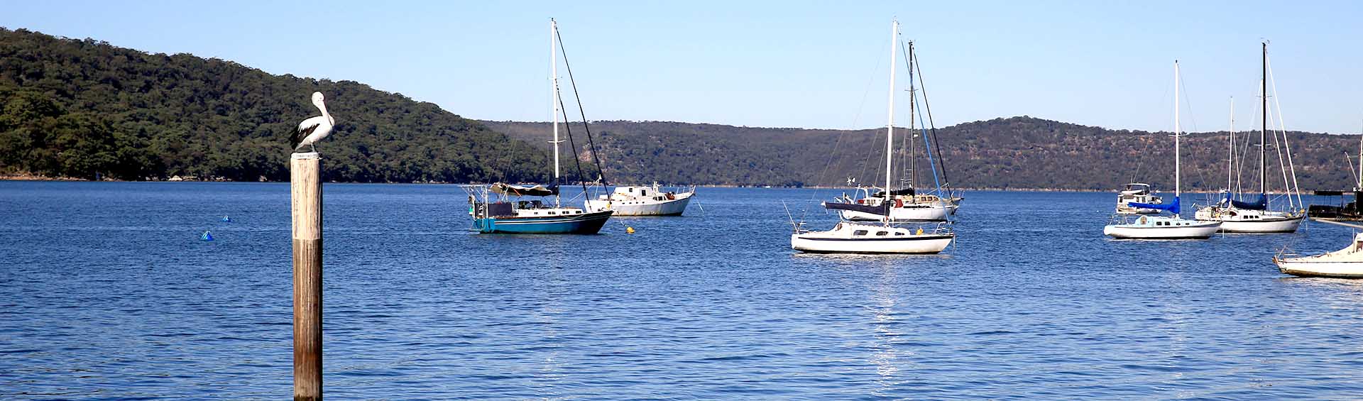
Hawkesbury Estuary
Estuaries host unique biodiversity and deliver a range of ecosystem services at the interface between catchment and the ocean – and where freshwater meets salt water.
The Hawkesbury Estuary is a drowned river valley that boasts the third largest stand of mangroves in New South Wales, as well as ecologically important seagrass meadows and remnant areas of saltmarsh. The beautiful mix of sandstone cliffs and gorges, open waterways, secluded bays and natural vegetation make the estuary one of the most visually spectacular waterways in New South Wales and a popular site for a large number of recreational visitors each year. A large proportion of its catchment is National Park containing significant forests with relatively little development.
Major tributaries to the estuary include Mangrove, Berowra, Mooney Mooney, Mullet and Cowan creeks. Riverside settlements are restricted to a few secluded spots with much of the foreshore only accessible by boat. The area is also rich in Aboriginal and European history.
Issues facing the Hawkesbury estuary
The most pressing issues facing the health of the Hawkesbury estuary include:
- Water quality including swimming conditions at recreational sites.
- Urban development and change in land use exceeding the capacity of what the estuary can cope with.
- A multitude of diffuse sources of polluted stormwater runoff. Council is addressing this through WSUD and the Catchments Remediation Rate Program to address the issue.
- Point-source sewage pollution from septic tanks and onsite wastewater management systems at riverside settlements and from wastewater treatment plants operating at limited capacity during wet weather events.
- Outbreaks of toxic and non-toxic algal blooms compromising the health of the estuary and impacting recreational activities.
- Illegal discharge of untreated sewage from boats. Council operates a free pump-out facility at Kangaroo Point to dispose of effluent. Boats require a 40mm (or 1 1/2") male camlock coupling to connect to the facility.
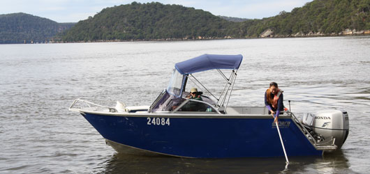
- Increasing pressure from boating and tourism pursuits. The Hawkesbury River is a very popular waterway, contributing an estimated $32.2 million to the local economy. Recreational activities include boating, water-skiing, sailing, fishing, swimming and kayaking. The region also sustains a large number of commuter vessels used by people living on islands and other isolated riverside locations.
- Disease outbreaks impacting local aquaculture enterprises (e.g. oyster farming).
- Variable prawn and fish stocks compromising annual catches and the long-term viability and sustainability of the commercial fishing industries.
The Hawkesbury-Nepean estuary is among the top 15 commercial fishing production areas in NSW, with annual catches worth $1.3 million. The estuary also plays a valuable role as a nursery and a source of food for ocean fish. Prawn catches may be worth up to $1.1 million per year, the second highest production area in NSW. Estuary prawn trawlers are restricted to fish in specific locations of the estuary as per an Estuary Prawn Trawl Share Management Plan.
The Hawkesbury oyster industry production has varied significantly in the last years as a result of the impact from different oyster diseases: QX disease in 2003 and Pacific Oyster Mortality Syndrome in 2013. Council is part of an intensive research effort to get the oyster industry back in the estuary. Currently Sydney Rock Oysters, triploid Pacific Oysters and Akoya Pearl Oysters are being cultivated in the lower Hawkesbury estuary.
Both the Oyster and Prawn Trawler industries have developed either an Environmental Management System (EMS) or an Environmental Action Plan (EAP). The Hawkesbury Trawl Association developed an EAP as the vehicle to bring together trawl operators and others within the community with an interest in tackling the issues threatening the health of the river while improving industry’s performance with regards to the environment.
On the other hand, the Broken Bay Oyster Association developed an EMS and then in 2011 signed a landmark Memorandum of Understanding with Hornsby Shire Council for the protection of the estuarine environment. It is the first formalised ongoing partnership, between a local government authority and an oyster industry group, that recognises their shared goals in protecting water quality. The agreement benefits the public, the environment and the economy by protecting estuarine health and supporting an environmentally sustainable oyster industry. Both parties seek to responsibly manage estuarine resources on behalf of present and future generations.
Useful links
The Hawkesbury’s riparian vegetation between Wisemans Ferry and Brooklyn is dominated by vegetation communities made up of Casuarina glauca (Swamp Oak), Eucalyptus robusta (Swamp Mahogany), Eucalyptus tereticornis (Forest Red Gum), Phragmites australis (Common Reed), Melaleuca linariifolia (Narrow-leaved Paperbark) and Melaleuca quiquenervia (Broad-leaved Paperbark). The transition from freshwater to estuarine vegetation communities occurs near Wiseman’s Ferry, where isolated patches of Aegiceras corniculatum (River Mangrove) are present. Fringing stands of the two predominant mangrove species, River and Grey Mangrove (Avicennia marina), become more abundant as you travel downstream from Laughtondale. There are significant areas of wetlands and saltmarsh communities present between Wiseman Ferry and Spencer.
Macrophytes are aquatic flowering plants, that often grow fully submerged (under water) by attaching to the sediments of wetlands and estuaries. Our key macrophyte groups in the Hawkesbury are mangroves, saltmarsh and seagrasses. Mapping of macrophytes have been undertaken by NSW Department of Primary Industries (DPI). Latest maps showing the spatial extent of each macrophyte type can be viewed on the Fisheries portal.
Wetlands are distinct ecosystems that get flooded by water, either permanently (for years or decades) or seasonally (for weeks or months). Wetlands are considered among the most biologically diverse of all ecosystems, serving as home to a wide range of plant and animal species. The water in wetlands is either freshwater, brackish or saltwater. The main wetland types are classified based on the dominant plants and/or the source of the water. For example, marshes are wetlands dominated by emergent vegetation such as reeds and sedges.
Wetlands are also known for their ecosystem services that include water purification, groundwater replenishment, stabilisation of shorelines and storm protection, water storage and flood control, and the processing of carbon (carbon fixation, decomposition and sequestration), other nutrients and pollutants. Learn more about a Council managed freshwater wetland in the next section below.
One Tree Reach Wetland is a Council owned and managed freshwater wetland that has limited saltwater influence and is located in the lower Hawkesbury estuary near Laughtondale
One Tree Reach wetland provides significant habitat for a diverse range of species (terrestrial and aquatic) and assists with filtration of surface water run-off before entering the river. The wetland is comprised of open water and a variety of habitats including mangrove and a number of endangered vegetation communities (Swamp Mahogany Forest, Floodplain Paperbark Scrub, Forest Red Gum River Flat Forest and Floodplain Reedland) in relatively undisturbed condition. These vegetation communities are forms of Swamp Sclerophyll Forest found principally on coastal floodplains of the NSW North Coast, Sydney Basin and Southeast Corner Bioregions and are listed as Endangered Ecological Communities (EEC) under the NSW Threatened Species Conservation Act 1995. For this reason, the Wetland is considered to have high conservation value and Council has undertaken significant on-ground and remedial works to improve the overall ecological condition of the wetland, its visual amenity and public accessibility. The wetland is a popular destination for bird watching and features a nature trail, boardwalk and interpretative signs.
The wetland is known to support a diversity of wading and forest bird species including White-faced Heron, Sacred Kingfisher, Purple Swamphen (nesting) and Black Swan (nesting). Fish and crustacean species within the wetland include Gobies, Gudgeons, Australian Bass, Glass Shrimp, Red-fingered Marsh Crabs and Spider Crabs.
One Tree Reach Wetland Gallery
Hornsby Shire Council is currently preparing the Hawkesbury River System Coastal Management Program (CMP). The Scoping Study must be prepared in accordance with the requirements of the Coastal Management Act 2016 (CM Act), the State Environmental Planning Policy (Coastal Management) 2017 (CM SEPP) and the NSW Coastal Management Manual.
Six Councils along the Hawkesbury River System have come to the agreement of partnering in the development of the Hawkesbury River System Scoping Study. The lead agency for this engagement is Hornsby Shire Council. Partnering Councils area: Hawkesbury City Council, The Hills Shire Council, Central Coast Council, Ku-ring-gai Council and Northern Beaches Council. The area considered for the Scoping Study is between Yarramundi to the estuary entrance between Box Head and Barrenjoey Head including Pittwater, Patonga and Brisbane Waters.
Further information on Coastal and Estuary Planning in the Hornsby LGA can be found here.
Through the implementation of the Lower Hawkesbury Estuary Management Plan, an advisory committee was formed made up of representatives from Hornsby Shire Council, Central Coast Council, NSW Government, Boat Owners Association, commercial fishers, representatives of community associations, local marina operators, commercial oyster farmers and Sydney Water Corporation. The Committee assists Council to improve the overall health of the estuary. This includes the chemical, physical and biological health, as well as the economic, recreational and aesthetic values.
The Lower Hawkesbury Estuary Management Plan Committee has been overseeing the implementation of the Lower Hawkesbury Estuary Management Plan between 2008-2019. The committee will continue to play a key role in the development of the Hawkesbury River System CMP. Meetings will be organised in a needs-based during 2020/21.
Minutes from past meetings
2020
2019
2018
- Nov 2018 - Minutes - 176kb
- Aug 2018 - Minutes - 220kb
- May 2018 - Minutes - 324kb
- March 2018 - Minutes - 262kb
2017
- Nov 2017- Minutes - 176kb
- Aug 2017 - Minutes - 220kb
- May 2017 - Minutes - 324kb
- March 2017 - Minutes - 262kb
2016
- November 2016 - Minutes - 268kb
- 18 August 2016 - Minutes - 263kb
- 19 May 2016 - Minutes - 272kb
- 17 March 2016 - Minutes - 333kb
2015
2014
2013
- 21 November 2013 - Minutes - 257kb
- 22 August 2013 - Minutes - 108kb
- 23 May 2013 - Minutes - 103kb
- 21 March 2013 - Minutes - 61kb
2012
- 22 November 2012 - Minutes - 159kb
- 23 August 2012 - Minutes - 58kb
- 24 May 2012 - Minutes - 58kb
- 22 March 2012 - Minutes - 59kb
2011
- 24 November 2011 - Minutes - 38kb
- 22 September 2011 - Minutes - 51kb
- 19 May 2011 - Minutes - 36kb
- 31 March 2011 - Minutes - 40kb
2010
- 25 November 2010 - Minutes - 39kb
- 23 September 2010 - Minutes - 38kb
- 24 June 2010 - Minutes - 33kb
- 25 March 2010 - Minutes - 31kb