


Bushland Management
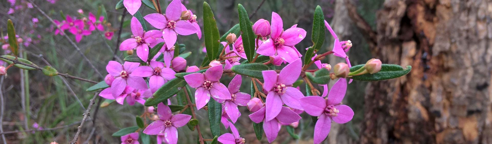
Hornsby Shire Council is directly responsible for 2,000 hectares of bushland, much of it adjoining Berowra Valley National and Regional Park. There are more than 1000 native plant species and 338 native vertebrate animal species within Hornsby Shire.
What are Council's responsibilities?
- biodiversity planning and policy
- bushland restoration
- weed control
- green offsets and biobanking
- bushland tracks and trails
- bush fire management
- community involvement
Current Bush Regeneration Sites
Since 1993 Hornsby Shire Council has operated a concerted campaign to regenerate the bushland, working at more than 50 sites throughout the Shire.
For the most part this involves the systematic removal of weeds to allow native plants to return. A number of methods are used, including manual and mechanical weeding, chemicals, biological means and even fire.
Biodiversity Conservation Strategy
The Biodiversity Conservation Strategy aims to protect native plants and animals, allowing for their continued survival and evolution in Hornsby Shire. Actions to meet this goal include the Catchment Remediation Program and Council's ongoing Bushcare program.
Biodiversity Conservation Strategy
Regeneration case study: Devlins Creek
Devlins Creek runs through the Chilworth and Beecroft Reserves, which are managed by Hornsby Shire Council and are part of an important wildlife corridor. Gang gang and glossy black cockatoos, powerful owls, green and gold bell frogs and other significant fauna are known to inhabit this reserve corridor.
Between 2008 and 2011 Hornsby Shire Council undertook a significant restoration of Devlins Creek, aided by a $92,000 sponsorship from Hills M2 Transurban.
The work included:
- The removal of weeds, including vines, which were replaced with native plants
- Improving walking tracks within the reserve
- Installing interpretive and directional signs
- Open days and bushland activities for local residents
- The promotion of Bushcare activities within the M2 corridor
- Free guided bushwalks
Know your weeds from natives
There are many plants in your garden that might look like weeds but are actually native plants. To make sure you're removing the right ones, check out Hornsby Shire Council's Native and Weed Look-Alikes book.
This field guide shows the difference between more than 100 natives and weeds in Hornsby Shire. It also provides information on weed removal techniques, a glossary of terms and useful references for further information.
Below you can find the book's chapters in pdf format.
- Introduction - 365kb
- Groundcovers - 1.7MB
- Grasses and Sedges - 1.4MB
- Vines - 4.3MB
- Weed removal techniques, Glossary, References and Plant Index - 484kb
- Shrubs - 1.6MB
- Trees - 1MB
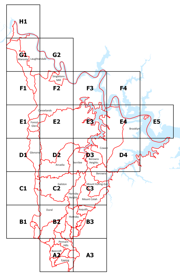
Native vegetation maps
The bushland of Hornsby Shire has been mapped, with 34 native vegetation communities identified.
An updated study was conducted in 2008 and can be accessed here: Native Vegetation Communities 2008 Update - 2MB
There are also Native Vegetation Communities Maps for specific areas:
Residents can also identify native vegetation with Hornsby Shire Council’s Guide to native trees in the Bushland Shire.
Bushland Projects
Information and updates about bushland projects that are in construction.